This ‘n’ That!

This week we take a trip to a variety of locations across the United States of America and Austria thanks to our amazing contributors.

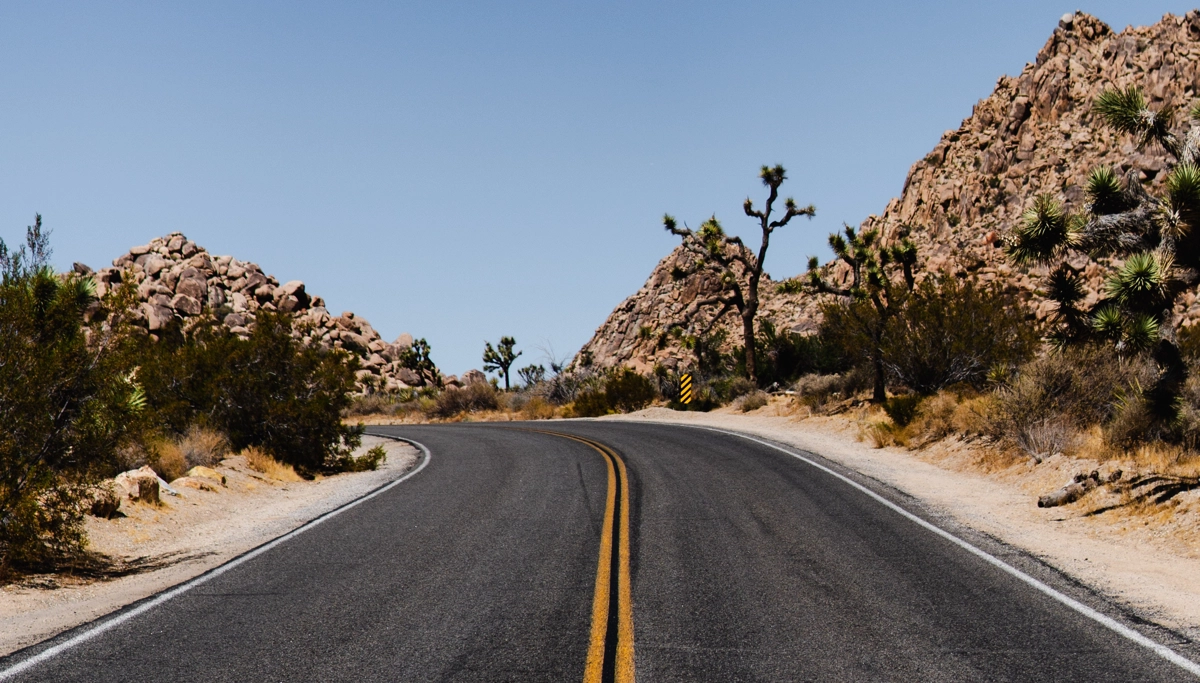
From the arid deserts of Arizona to the stunning valleys of Boulder, Colorado, this series is a visual feast.

We also visit Utah’s Zion National Park for something a little bit different.

Thank you to Tom Gosnell, Eric Baer, Elon Mehr, and Pat Fulghum for their stunning contributions this week.

As an added bonus, in this collection, you’ll also find a fresh route from former pro-rider Hans-Peter Obwaller which is full of stunning Austrian climbs, valleys, and views worthy of a postcard.
MT. EVANS SHORT

Mt. Evans is an epic climb to the top of the highest paved road in North America. This is the route of the annual Bob Cook memorial hill climb race to the summit. This shorter version starts at the half way point called Echo Lake. The road is closed to vehicle traffic after this point in 2020, so it's an ideal time to ride. We're in the trees for a very short while but move into an alpine environment for the long climb to the summit. The lack of oxygen at 14,000ft / 4200M makes it a difficult climb.

More Info
23.14km
DISTANCE
02:10:27
DURATION
1103m
ELEVATION

COAL CREEK

Join Eric for a cruise along the canyons and valleys of Coal Creek in Colorado. Bright blue skies and autumnal foilage make this a stunning route. But be warned, it's a solid climb to the summit.

More Info
22.64km
DISTANCE
01:17:22
DURATION
753m
ELEVATION

KALSER GLOCKNERSTRASSE LUCKNERHAUS

The Kalser Glocknerstrasse up to the Lucknerhaus (which is the basecamp for all those you want to climb the Großglockner - highest mountain in Austria at 3798m). The Lucknerhaus is at 1920m and you will reach it after 5km flat and 20km uphill. It is tough climb which was used in the Tour of Austria in the 80's. Beautiful high alpine views during the climb guaranteed.

More Info
46.87km
DISTANCE
02:07:57
DURATION
1250m
ELEVATION

LEGACY TRAIL (FORMERLY BLUEBONNET TRAIL)

A ride along the Legacy Trail in Texas on a crisp cool morning. Bright blue skies and a flat profile make this a great recovery ride for those on an easy day.

More Info
10.19km
DISTANCE
00:29:17
DURATION
53m
ELEVATION

LEFTHAND LEE HILL

Lefthand canyon is located north of Boulder, Colorado and is a local cycling favorite. Named after the Arapahoe tribal leader, Chief Niwot (lefthand) the valley is a scenic ride along Lefthand creek. The road was devastated by floods in 2013 but has since been rebuilt with bike lanes and a smooth road surface. It's a comfortable uphill grade until we get to the turnoff for Lee Hill road. This is a quick climb up and over a ridge. Once over the top, Lee Hill road is a fun and fast descent back to North Boulder.

More Info
18.95km
DISTANCE
00:52:20
DURATION
414m
ELEVATION

AJO MOUNTAIN DRIVE

This is a ride through Organ Pipe Cactus National Monument. It is a gravel route with views of Ajo mountain, Sonoran desert and both organ pipe and saguaro cactus. The first half of the ride features a challenging climb while the second half features swooping downhills. Be sure to notice the arch in mile 9 (15km).

More Info
33.38km
DISTANCE
01:43:57
DURATION
433m
ELEVATION

MAROON BELLS

It’s a nice climb through scenic aspen trees.

More Info
13.56km
DISTANCE
00:53:06
DURATION
516m
ELEVATION

ZION NATIONAL PARK SCENIC CANYON

Zion National Park is located near Springdale, Utah, USA and offers some unbelievable views of natural rock formations and picturesque landscapes. Some 220 square miles (570 km^2) of explorable land was set aside as a national park in 1919. Zion Canyon is 15 miles (24km) long and in some parts half a mile deep. The canyon is made up of beautiful reddish tan-colored Navajo Sandstone. This ride features the "Scenic Drive" section which is closed to cars, but is open to bikes and park shuttles. Bikes must pull over and stop for the shuttles as they will not pass a moving bike. This ride is an out and back so you can see the natural beauty from both directions. This ride is also a loop in case you need a bit more distance.

More Info
20.06km
DISTANCE
00:44:28
DURATION
150m
ELEVATION

ZION NATIONAL PARK WEST TUNNEL

Zion National Park, located in Southern Utah, near Springdale, Utah, USA offers some unbelievable views of natural rock formations and picturesque landscapes. Zion National Park is known for its hiking and sightseeing adventures. Gaze up at massive sandstone cliffs of cream, pink, and red that soar into a brilliant blue sky as you climb 750ft of elevation over 3.5 miles to the entrance of the mile-long Zion-Mt. Carmel Tunnel. The tunnel is closed to pedestrians and bikes, but the scenery on the two approaches to the tunnel are stunning. The tunnel is our turn around point and you get to enjoy the fast descent back to your starting point.

More Info
10.97km
DISTANCE
00:27:45
DURATION
232m
ELEVATION

BOISE DUMP LOOP CCW

This 18 mile (29km) loop is commonly named "Dump Loop." It is in the foothills of Boise, Idaho, USA and goes by the Ada County landfill, thus its name. It features 3 relatively short and not too steep climbs, a couple of fast descents, and a nice 5-mile time trial back. It can be ridden in either direction, but going counter-clockwise the climbs are just a bit steeper (11%). This is a very popular local route and cars share the road very well with the bikers. If you look to the sides of the hills you will see some mountain bike riders on some of the trails along this route. This ride was filmed on an early spring day before the trees are green, and you can tell that Boise sits right on the edge of the high desert and the Boise National Forest.

More Info
28.51km
DISTANCE
01:02:29
DURATION
495m
ELEVATION

Subscribe to FulGaz

Now available on a wide choice of platforms including Android, Apple TV, iPad, MacOS, iPhone and Windows. FulGaz offers you the ultimate ride!

Pricing