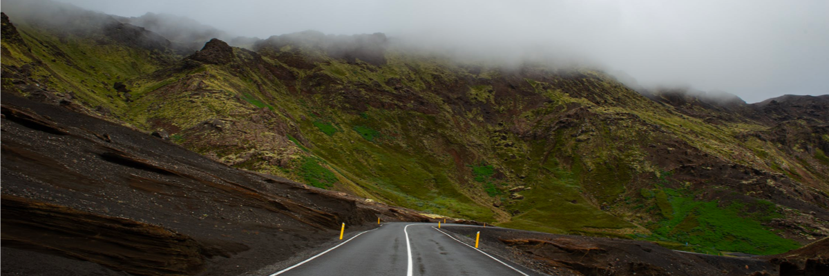
Official Climbs

Author Simon Warren started categorising the greatest climbs of the UK a few years ago and FulGaz is excited to have a number of them on the app. You can find out more about Simon Warren and his official climb collections on his blog.

If you’re looking for a real challenge, you can gradually work your way through this list but be warned we add more official climbs on a regular basis so it’s an ever-growing list.

We are aiming to add all of the official climbs of the UK and you can find these under the Official Climbs ride channel, or by searching “OC” in the app.

OC-1 CHEDDAR GORGE

Cheddar Gorge is a limestone gorge in the Mendip Hills, near the village of Cheddar, Somerset, England. The climb through the gorge is UK Official Climbs #1.

The gorge is the site of the Cheddar show caves, where Britain's oldest complete human skeleton, Cheddar Man, estimated to be 9,000 years old, was found in 1903.

Although not as tough as many of the other official climbs, it attracts many thousands of cyclists every year to experience the unique ascent through the limestone cliffs.

More Info
OC-1 Cheddar Gorge
11.03km
DISTANCE
0:29:22
DURATION
256m
ELEVATION

OC-103 LONGLEAT ON SAFARI

Starting out with great views of one of England’s most famous country houses, Longleat in Wiltshire, home of the world famous safari park, this ride’s stately progress takes in another of the county’s stately homes, Stourhead, renowned for its picturesque landscape garden. The ride ends with Official Climbs #103 as we come full circle back to Longleat after completing a 50k circuit of the rolling Wiltshire landscape.

More Info
OC-103 Longleat On Safari
47.57km
DISTANCE
1:42:22
DURATION
674m
ELEVATION

OC-11/OC-8 RUNDLESTONE AND DARTMEET

After leaving the ancient market town of Tavistock, the ride takes in two very different categorised climbs. Rundlestone (Official Climbs #11) is long with a max of 15% whereas Dartmeet (Official Climbs #8) is short and very steep.

The lumpy ride over the beautiful Dartmoor landscapes finishes in the tourist village of Widecombe in the Moor.

Watch out for the close shave with Shaun the Sheep.

More Info
OC-11/OC-8 Rundlestone and Dartmeet
27.7km
DISTANCE
1:17:06
DURATION
762m
ELEVATION

OC-122 SPRIG'S ALLEY AND KINGSTON HILL

A rolling loop on the edge of the Chilterns Hills, descending to the Aylesbury Plain at Bledlow, before tackling Kingston Hill (Official Climbs #122).

More Info
OC-122 Sprig's Alley and Kingston Hill
26.5km
DISTANCE
1:10:06
DURATION
358m
ELEVATION

OC-124 LAVENHAM AND THE STOUR VALLEY

Starting in Kersey, one of the most scenic villages Suffolk has to offer and often regarded as a hidden gem with quintessential medieval timber-framed houses and a ford. We head off through more chocolate box villages with pretty thatched cottages, historic churches and picturesque gardens climbing Watson’s Hill (Official UK Climbs #124) before passing through Chelsworth, Monks Eleigh and Brent Eleigh before arriving at the spectacular village of Lavenham. From here we drop into the Stour Valley at Long Melford and follow it through Cavendish to finish the ride at Clare where we have the choice of many pubs or tea shops to call into for refreshments!

More Info
OC-124 Lavenham and the Stour Valley
39.34km
DISTANCE
1:32:33
DURATION
368m
ELEVATION

OC-125 THE SHERINGHAM RIDGE

For anyone who thinks Norfolk is flat, this is a ride many locals head for to get some hill training.

The Sheringham Ridge is a glacial feature extending from Mundesley on the coast in the east and runs west, parallel along the coast past Cromer and Sheringham continuing then inland to Holt and rises up to 100m in places.

We start our ride at Weybourne station as a steam train stops at the platform and head up our first climb soon to drop back onto the coast road and past the lovely cobbled cottages of Upper Sheringham and climb our second hill. Once again, dropping back to sea level only to climb our third climb at Beacon Hill (Official UK Climbs #125). Our final descent to East Runton and a cliff top ride to our finish at Cromer overlooking the pier.

Enjoy!

More Info
OC-125 The Sheringham Ridge
19.51km
DISTANCE
0:49:02
DURATION
236m
ELEVATION

OC-127 CHATSWORTH AND BEELEY

Visit Chatsworth Park, home to the Duke of Devonshire, and return over the moors to Holymoorside.

Starting in Old Brampton, the ride passes through Baslow then takes back routes to Hassop, and through wooded lanes to Chatsworth Park. Once through the park, you will get to the hamlet of Beeley which signals the start of a long steady climb (Official Climbs 127). Then ride over the moors and end with a long fast descent into Holymoorside, on the outskirts of Chesterfield.

More Info
OC-127 Chatsworth and Beeley
30.87km
DISTANCE
1:21:16
DURATION
683m
ELEVATION

OC-14 BOX HILL LOOP 2020

Box Hill is a summit of the North Downs in Surrey.

The hill takes its name from the ancient box woodland found on the steepest west-facing chalk slopes overlooking the River Mole. Box Hill featured prominently on the route of the 2012 Summer Olympics cycling road race events, the men doing nine circuits and the women doing two circuits.

More Info
OC-14 Box Hill Loop 2020
12.23km
DISTANCE
0:31:16
DURATION
185m
ELEVATION

OC-14 BOX HILL AND RANMORE COMMON 2020

Box Hill (OC-14) is a summit of the North Downs in Surrey.

The hill takes its name from the ancient box woodland found on the steepest west-facing chalk slopes overlooking the River Mole. Box Hill featured prominently on the route of the 2012 Summer Olympics cycling road race events, the men doing nine circuits and the women doing two circuits.

After completing the Box Hill loop, cross under the A24 to Westhumble to test your legs up Ranmore Common Road, finishing at Denbies Hillside high up on the common.

More Info
OC-14 Box Hill and Ranmore Common 2020
17.4km
DISTANCE
0:49:14
DURATION
338m
ELEVATION

OC-14/OC-17/OC-18 TRIPLE TROUBLE IN THE SURREY HILLS

This is a classic Sunday “club run” route taking in three main climbs through the picturesque, sweeping roads of Surrey.

Today you’ll start with a warm-up climb up Box Hill’s famous Zig Zag Road (OC-14). There’ll be no stopping at the National Trust Café today as you ride over Ranmore Common to Shere, and past another great Sunday ride café stop (The Dabbling Duck) before the road climbs once again up Leith Hill (OC-17).

The last climb of the day is the toughest – White Down Lane (OC-18). Save your legs for the main climb which starts after the railway bridge, where the narrow road pitches to above 18%. The perfect place to drop your clubmates and earn post-ride bragging rights!

From here it’s mostly downhill as you flush the lactic acid out of well-spent legs on the return journey back to Ryka's cafe. See you again at the same time next week!

More Info
OC-14/OC-17/OC-18 Triple Trouble in the Surrey Hills
63.4km
DISTANCE
2:55:59
DURATION
1134m
ELEVATION

OC-144 GREETS MOSS AND REDMIRE

Filmed on the hottest day in UK history, this loop starts and finishes in Leyburn in the heart of the Yorkshire Dales with a steady climb onto the top of Grinton Moor. Keep your head down as you pass the Army live firing ranges, before climbing Greets Moss (Official Climbs #144) to return to Wensleydale and a loop around Bolton Castle which held Mary, Queen of Scots for six months in 1568.

Finish the loop with a nice 3.5km TT stretch coming out of Redmire into Wensley.

More Info
OC-144 Greets Moss and Redmire
27.21km
DISTANCE
1:24:34
DURATION
605m
ELEVATION

OC-145 CôTE DE LOFTHOUSE 2021

Côte de Lofthouse (Trapping Hill) was used twice in the 207 Tour de Yorkshire, once in the morning on day 2 of the women's race and later in the afternoon by the men. It re-appeared in the women's road race in the UCI World Championships in 2019, the scene of Lizzie Deignan's attempted breakaway.

It’s a relentless, brutal ascent starting in Lofthouse, which reaches 20% at a left hand bend before easing off for the final 2Km to the cattle grid at the summit.

Can you get to Masham before the storm arrives?

Official Climbs #145.

More Info
OC-145 Côte de Lofthouse 2021
27.16km
DISTANCE
1:10:23
DURATION
473m
ELEVATION

OC-145 OLD AND PECULIER BLACK SHEEP

A long rolling loop around Nidderdale, beginning and ending at Pateley Bridge and passing through Masham, home to the Theakston (Old Peculier) and Black Sheep breweries.

Climb up Côte de Lofthouse (Trapping Hill, Official Climbs #145) and then enjoy the fast descent to Masham via Leighton Reservoir. Dodge the first storm of the day at Masham, then continue along the 2019 UCI Worlds iTT course to Kirby Malzeard, and climb again across the moors. Dodge the day's second storm which arrives just before the fast and pedal-free descent back to Pateley Bridge.

All of these roads have been used by the Tour de Yorkshire and/or the 2019 UCI Worlds; this complete loop would have been used for the first time in the (cancelled) 2020 TdY, preceded and followed by a descent and then a climb of Greenhow Hill.

More Info
OC-145 Old and Peculier Black Sheep
49.08km
DISTANCE
2:13:07
DURATION
891m
ELEVATION

OC-147 SLEIGHTS MOOR

As Simon Warren says in his 100 Greatest Cycling Climbs book, there are so many 33% hill signs in North Yorkshire, they must have got a bulk deal. The climb starting at the steam railway in the Grosmont up onto Sleights Moor (Official UK climb #147, length 3km, height gain 177m) isn’t the 33% that is signposted, but it is steep at the beginning and a long hard slog all the way to the finish high up on the Moors. The ride starts and finishes overlooking the harbour in Whitby.

More Info
OC-147 Sleights Moor
29.19km
DISTANCE
01:10:25
DURATION
560m
ELEVATION

OC-148 NOUGHT BANK ROAD

Greenhow Hill may be the well-known climb out of Pateley Bridge, but Nought Bank Road provides a quieter and more scenic alternative. The ride turns off the main road just outside of Pateley Bridge and takes a narrow lane up to Yorke’s folly and onto Heyshaw Moor. With the climbing out the way, enjoy the scenery and descent back down to the river Nidd and then run back to the starting point on Pateley Bridge High Street.

More Info
OC-148 Nought Bank Road
16.46km
DISTANCE
00:38:30
DURATION
371m
ELEVATION

OC-149 CAPER HILL AND OC-55 ROSEDALE CHIMNEY

This ride climbs two 10/10 hills in the North Yorkshire Moors.

Caper Hill (Official UK climb #149, length 1.2km, height gain 174m) and the more famous Rosedale Chimney (Official climb #55, length 1.4km, height gain 179m). Like all the best hills, both are visible in the far distance as you approach them just to intimidate you. The ride starts in Egton, passes through the scenic Glaisdale and climbs Caper Hill up onto the moors before descending into the village of Rosedale. The chimney has a feared reputation among cyclists as one of the steepest roads in the UK, so provides a challenging finish.

More Info
OC-149 Caper Hill and OC-55 Rosedale Chimney
19.41km
DISTANCE
00:57:55
DURATION
542m
ELEVATION

OC-150 EGTON HIGH MOOR

The climb from Egton Bridge up onto Egton High Moor is the longest climb in the North Yorkshire Moors at over 7km in length. The good news is the steep section comes early and the reward for the long gradual drag to the summit is the stunning scenery in this isolated part of the moors. All the better for the purple heather when the ride was recorded. The ride climbs up onto the moors and then rather than continue to Rosedale and the dreaded Chimney, turns around for the exhilarating decent back to Egton bridge.

More Info
OC-150 Egton High Moor
21.79km
DISTANCE
00:53:32
DURATION
427m
ELEVATION

OC-162 CULLEN SKINK

A modest challenge climbing over the picturesque Duke's Pass from Aberfoyle in the Scottish Highlands, descending to the Tigh Mor hotel beside Loch Achray, a favourite of Queen Victoria.

The pass was constructed by the Duke of Montrose in 1885. Official climbs #162.

More Info
OC-162 Cullen Skink
9.96km
DISTANCE
0:28:32
DURATION
251m
ELEVATION

OC-17/OC-18 LEITH HILL AND WHITE DOWN LANE

Take on these two notorious Surrey hills on a late summer's day under sunshine and blue skies.

Although they are comparable in both distance and height gained, White Down Lane (OC-18) is a much harder climb as it doesn't start ramping up until you have crossed the railway bridge, over halfway through the segment. Leith Hill (OC-17) is first up, immediately after the start, so make sure that you've warmed your climbing legs up.

More Info
OC-17/OC-18 Leith Hill and White Down Lane
18.64km
DISTANCE
0:52:41
DURATION
357m
ELEVATION

OC-176 NEWTON FELL

Climb up to Newton Fell from Waddington.

Simon Warren's Official climbs #176.

More Info
OC-176 Newton Fell
4.45km
DISTANCE
00:17:48
DURATION
277m
ELEVATION

OC-181 THE STRUGGLE

Kirkstone Pass is the highest pass in the Lake District, with three ways to the summit. The most scenic and hardest is appropriately named “The Struggle” (Official UK Climb #181, length 4.6Km, height gain 386m). Starting just north of Grasmere, ride to Ambleside where the Struggle starts. It’s tough straight away with a slope of 20% as you climb out of the town. The scenery becomes rural and then open moorland as the road climbs ever higher. Sighting the white Kirkstone Inn on the horizon signals the top is near, but there is still a final testing 20% section before the summit.

More Info
OC-181 The Struggle
12.73km
DISTANCE
00:37:21
DURATION
438m
ELEVATION

OC-182 RED BANK AND BLEA TARN FROM AMBLESIDE

Blea Tarn is described in Simon Warren’s book “Another 100 Greatest Cycling Climbs” as a Supermodel (Official UK Climb #182, 1.1Km, height gain 128m). It’s not the steepest or longest hill in the Lake District, but it is a lovely, twisting climb. To get there, the ride leaves Ambleside and heads to Grasmere, climbs Red Bank, which in itself is a tough, shady climb between moss-covered stone walls, before the flat approach to the base of Blea Tarn through Great Langdale.

More Info
OC-182 Red Bank and Blea Tarn from Ambleside
23.67km
DISTANCE
00:54:45
DURATION
411m
ELEVATION

OC-186 GREAT DUN FELL

Arguably the very best climb in the UK, this ride takes you up to the National Air Traffic Services radar station Get ready for a tough workout with a real grin inducing summit. 

More Info
OC-186 Great Dun Fell
7.41km
DISTANCE
00:44:59
DURATION
617m
ELEVATION

OC-189 THE LLANBERIS PASS

A long but comparatively easy climb through the Llanberis Pass, Official Climbs #189, riding southeast into the early morning sunrise. Return via Beddgelert, following the route of the Welsh Highland Railway as far as Waunfawr before the final climb back to your starting point. At the start of the ride there are glimpses of former slate quarries, relics of Wales' industrial past.

Snowdon, Wales' highest peak, is always on your right on this clockwise loop through the practically deserted Snowdonia National Park in early Feb 2020.

More Info
OC-189 The Llanberis Pass
46.06km
DISTANCE
1:58:11
DURATION
659m
ELEVATION

OC-192 DYFI FOREST

After a gentle cruise down the scenic Dyfi valley, this ride heads out into the wilderness of the Dyfi Forest for the challenge of Official Climbs #192, an iconic climb in North Wales, and a mecca for gravel and mountain bikers.

From 12.5Km to 17.5Km, the route follows a part of Stage 4 of the 2021 Tour of Britain.

More Info
OC-192 Dyfi Forest
42.87km
DISTANCE
1:33:13
DURATION
675m
ELEVATION

OC-194 GOSPEL PASS

This narrow lane snaking over the Black Mountains between Monmouthshire and Powys is the highest stretch of road in Wales, Official Climbs #194. The pass is flanked by the peaks of Waun Fach (811m) to the west and Hay Bluff (677m) to the east, which is also the English border.

More Info
OC-194 Gospel Pass
9.88km
DISTANCE
0:23:54
DURATION
288m
ELEVATION

OC-22 DITCHLING BEACON

15.6km through the quiet roads of Sussex, along the base of the beautiful South Downs, an Area of Outstanding Natural Beauty, and then culminating with a climb of Ditchling Beacon (OC-22). This is a 1.5km climb, average 10% max 17%, and is one of the best-known climbs in the South East of England

More Info
OC-22 Ditchling Beacon
15.26km
DISTANCE
00:42:54
DURATION
355m
ELEVATION

OC-23 WHITELEAF HILL

Starting at The Harrow pub, ride through stunning country lanes near to the Prime Minister’s country retreat Chequers, before a fast, winding descent through Cadsden, passing The Plough pub on your left where David Cameron famously hosted China’s President Xi Jinping in 2015.

Don’t be fooled by the false flat half-way up Peters Lane, the vicious 20% of Whiteleaf Hill (Official Climbs #23) begins just ahead at the right-hand bend. Enjoy the fast, straight descent of Kop Hill (25% at the top) before another short, sharp climb up Wardrobes Lane, then a long, easy descent back to The Harrow pub.

More Info
OC-23 Whiteleaf Hill
23.34km
DISTANCE
1:03:15
DURATION
427m
ELEVATION

OC-24 STREATLEY HILL

The steep ramps around this rolling course will warm you up nicely for the main event, Streatley Hill (Official Climbs #24).

It is used in local clubs' Hill Climb trials who start a short way up, just as the gradient reaches its maximum of around 18%.

Watch out for the pheasants soon after you start the Crows Hill climb.

More Info
OC-24 Streatley Hill
16.49km
DISTANCE
0:48:04
DURATION
311m
ELEVATION

OC-25 INKPEN HILL

Inkpen Hill, or more correctly Coombe Gibbet (Official Climbs #25), is a short steep climb in a sleepy corner of Berkshire. You can count the many thatched roofs during your ride along deserted country lanes, enjoying the blue skies and a fine summer's day.

At the top of the hill, just visible directly ahead before you begin the final climb, is Coombe Gibbet, where the caged bodies of wrong-do'ers were hanged on public display, left to rot as a deterrent to others. Thankfully that gruesome practice finished in the early 19th century, and you have nothing to worry about in today's civilised English society as you struggle up the near-20% climb to return to your starting point.

More Info
OC-25 Inkpen Hill
33.28km
DISTANCE
1:22:25
DURATION
369m
ELEVATION

OC-33 WINNATS PASS

Starting in the Hope Valley we cycle through Castleton before hitting the slopes of Winnats Pass (OC-33) where gradients of 20% are long and steady. This was the venue of the 2021 National Hill Climb Championships. After reaching the top we pass Mam Tor (Shivering Mountain) on our right hand side before dropping into the Vale of Edale and heading back to the village of Hope to finish the loop.

More Info
OC-33 Winnats Pass
17.07km
DISTANCE
0:54:25
DURATION
363m
ELEVATION

OC-35 CURBAR GAP

Tackle Curbar Edge, one of the iconic Peak District climbs and #35 of the Official 100 climbs.

Starting in Old Brampton, the stockbroker belt of Chesterfield, the ride passes through the village of Baslow. After a nice level cruise alongside the River Derwent, you can expect 1.1 miles at an average 10% climb to Curbar Gap. Towards the top you will see the gritstone outcrops of Curbar Edge, a very popular walking spot. The ride ends in the village of Cutthorpe, on the outskirts of Chesterfield.

More Info
OC-35 Curbar Gap
25.32km
DISTANCE
1:04:14
DURATION
508m
ELEVATION

OC-38 IRONBRIDGE GORGE

A ride through Ironbridge Gorge, a UNESCO World Heritage Site, where the industrial revolution kickstarted in the 18th century.

Cross the River Severn over the famous iron bridge, the first major bridge in the world to be made of cast iron, then climb Jiggers Bank (Official Climbs #38). Ride back through the gorge with views of the bridge to your front right at 18Km, continuing along Coalport High Street before the steep and twisty climb up Sutton Bank to return to your starting point.

More Info
OC-38 Ironbridge Gorge
23.33km
DISTANCE
1:10:53
DURATION
435m
ELEVATION

OC-39 THE BURWAY AND LONG MYND

Make sure you are warmed up before starting this very tough rolling loop up onto the Long Mynd, with spectacular views into Wales from the top, and of the Shropshire hills as you begin your final descent. Fortunately the climb from Ratlinghope on the return leg isn't quite so steep.

The Burway, Official Climbs #39, was the venue for the 1989 National Hill Climb Championship, won by Chris Boardman.

"Straight up with a twist, Mr Bond".

More Info
OC-39 The Burway and Long Mynd
18.32km
DISTANCE
1:00:10
DURATION
536m
ELEVATION

OC-4 ENGLAND'S STEEPEST A-ROAD - PORLOCK HILL

Cyclists are welcome to try, but trucks and caravans are banned from driving up Porlock Hill due to the steepness! Official Climbs #4. Enjoy the challenge of cycling up this spectacular hill with 25% gradients on the two hairpins and 10% overall for the full 3.8Km (2.4 mile) climb.

More Info
OC-4 England's Steepest A-Road - Porlock Hill
5.3km
DISTANCE
0:26:12
DURATION
391m
ELEVATION

OC-42 JACKSON BRIDGE

Start with a gentle ride out before taking on Jackson Bridge (Official Climbs #42).

Take the opportunity to get your breath back with a fast descent to Holmfirth before heading over to Slaithwaite to start Cote de Scapegoat (Tour de Yorkshire in 2020).

More Info
OC-42 Jackson Bridge
28.89km
DISTANCE
1:18:33
DURATION
894m
ELEVATION

OC-43 HOLME MOSS

The ride starts in Holmfirth, made famous by the Last of the Summer Wine TV Series, before initially climbing up to Holme village to get you stretched and warmed up before tackling the actual climb up Holme Moss, official UK climbs #43. Descend back towards Holme before making a left to Digley Reservoir to the finish.

Holme Moss was traversed on Stage 2 of the 2014 TdF Grand Depart.

More Info
OC-43 Holme Moss
12.42km
DISTANCE
0:44:05
DURATION
457m
ELEVATION

OC-45 CôTE DE PARK RASH, TOUR DE YORKSHIRE 2018

Tackle the fearsome and relentless Côte de Park Rash just a few hours before the TdY peloton. Official UK Climbs #45. It gets slightly easier after the two 25% hairpins, but there are several more steep sections following, before the final climb bites at 20% with just 500 metres to go.

Look out for Dave Brailsford sitting down reading the newspaper just after you start the KOM climb. The large overhanging limestone rock face near the start of the ride is called Kilnsey Crag, a popular challenge for rock climbers.

More Info
OC-45 Côte de Park Rash, Tour de Yorkshire 2018
10.65km
DISTANCE
0:39:27
DURATION
372m
ELEVATION

OC-46 CRACKPOT AND OXNOP SCAR

Starting on a dead-end gravel track above the tiny hamlet of Crackpot, swoop down into Swaledale to cross the River Swale at Gunnerside.

Climb westwards through Gunnerside before re-crossing the River Swale over Ivelet Bridge. Oxnop Scar is now only 1 Km away, so make the most of the remaining gently rolling terrain.

The first few bends of the Oxnop Scar climb are awful! But once you pass 8.5Km, only a few steep pinches remain to pepper the long, rolling grind to the summit. Oxnop Scar is the steep cliff off to your left, visible from approx 11Km.

Official Climbs #46.

"Send for agent Triple-X".

More Info
OC-46 Crackpot and Oxnop Scar
12.33km
DISTANCE
0:53:45
DURATION
429m
ELEVATION

OC-47/OC-48 MALHAM COVE AND LANGCLIFFE SCAR

Mallham cove (OC-47) is one of the biggest tourist attractions in the Yorkshire Dales.

Visitors come to see the amazing wall of limestone at the back of the cove. Sadly, you only get glimpses from the ride, but the climb up onto Ewe Moor and to Malham Tarn is still stunning. After descending off the moors to the village of Stainforth, there is the climb up Langcliff Scar (OC-48) and between the rocky outcrops before descending back to the start in the village of Malham.

More Info
OC-47/OC-48 Malham Cove and Langcliffe Scar
25.8km
DISTANCE
1:06:08
DURATION
660m
ELEVATION

OC-49 SWALEDALE AND BUTTERTUBS

Starting in Reeth, ride eastwards along the sometimes steeply rolling Swaledale before tackling the mighty Buttertubs pass (Official Climbs #49).

Admire the views over vertiginous dip on your left hand side after the first crest on Buttertubs; this is a brief opportunity for you to rest your legs before the final climb to the summit with the steepest section of all at nearly 20%. Keep going as hard as you can until you reach the cattle grid.

"I do love an early morning ride, Mr Bond".

"Well, I'm an early riser myself".

More Info
OC-49 Swaledale and Buttertubs
19.847km
DISTANCE
1:08:56
DURATION
527m
ELEVATION

OC-5 DUNKERY BEACON

The ride starts with coast and moorland views before dropping sharply into and through Porlock. Official Climbs #5. A short steep climb along the narrow Chisland Drive warms you up for the main climb up to the Beacon. Initially through wooded slopes, the ride climbs steeply before opening out with typical southerly Exmoor views. Then the gradient eases somewhat for the final push to the top.

More Info
OC-5 Dunkery Beacon
13.89km
DISTANCE
0:46:01
DURATION
470m
ELEVATION

OC-50 FLEET MOSS

The highest road in Yorkshire, this Official UK Climbs #50 is a gut buster! Starting in the peaceful market town of Hawes we soon hit the first 17% slope at Gayle where the road then levels off a little before reaching the steeper slopes at 17% and topping out at 23% near the top.

The long ascent is always in view so you can see what is to come and you can be philosophical! Once at the summit and looking south, you will see the three highest peaks in Yorkshire, Whernside, Ingleborough and Pen-y-Ghent.

The road then drops into the beautiful Langstrothdale, the upper valley of the River Wharfe, and finishes at Yockenthwaite.

More Info
OC-50 Fleet Moss
14.40km
DISTANCE
00:49:30
DURATION
380m
ELEVATION

OC-51/OC-142 TAN HILL FROM WHAW

The long way up to the Tan Hill Inn, Official Climbs #51.

Warm your legs up first though, bearing left at Feetham to climb the steep Turf Moor (Official Climbs #142) onto open moorland. Look out for the red grouse flying across in front of you at 12.25Km, just after you complete the Turf Moor segment. This is the famous Red Grouse which appears on Scotch Whisky bottles. Although a protected species, hunting is permitted (eg the "Glorious Twelfth") providing local population levels are not threatened.

After reaching the Tan Hill Inn at 26Km, swoop back down to your starting point at Muker in Swaledale; this is the reverse of the Fulgaz ride "Tan Hill from Muker".

"Any higher Mr Bond, and my ears will pop".

More Info
OC-51/OC-142 Tan Hill from Whaw
37.95km
DISTANCE
1:48:18
DURATION
820m
ELEVATION

OC-52 GREENHOW HILL

The Côte de Greenhow Hill, at nearly 4Km/2.5 miles, is the Tour de Yorkshire's longest climb and is a tough test of the riders' legs coming late in the final Stage 4 of the race. Official climbs #52. There are three really steep sections with flatter sections in between, before the final climb tops out with stunning views of the Nidderdale valley.

Follow the Stage 4 route as it turns south towards Otley, then take in a tour of the Thruscross reservoir, looping back towards Pateley Bridge with a long climb onto the moors at Heyshaw, finishing with a fast, winding descent back to the finish at Glasshouses.

More Info
OC-52 Greenhow Hill
33.72km
DISTANCE
1:50:14
DURATION
864m
ELEVATION

OC-52 GREENHOW HILL TO GRASSINGTON

The Yorkshire Dales is a vast stretch of open moorland with a few villages tucked away in valleys or at its edges. This ride, along the main road from Pateley Bridge to the popular tourist village of Grassington, highlights the remote scenery as it sweeps across the moors. The climb out of Pateley Bridge up Greenhow hill is long, but the steep bits are in stages, giving some chance for recovery in between. After that, it is a fast, undulating run to Grassington, with the reward of its many good cafes and tea shops when you get there (in real life).

More Info
OC-52 Greenhow Hill to Grassington
17.10km
DISTANCE
00:45:24
DURATION
454m
ELEVATION

OC-53 NORWOOD EDGE

It's a blustery, overcast day in Otley. Can you make it around this 26Km loop before the rain arrives? After cresting Norwood Edge (Official Climbs #53), look out for the white golfball-like radar domes at RAF Menwith Hill, an extensive satellite ground station serving as a communications intercept and missile warning site for the UK MoD and the US DoD. Rest your legs on the fast descent to the shores of Swinsty Reservoir before beginning the long, steep climb to the ride's summit on Askwith Moor.

More Info
OC-53 Norwood Edge
26.12km
DISTANCE
1:14:37
DURATION
565m
ELEVATION

OC-57 ARKENGARTHDALE AND THE STANG

Starting in lower Swaledale, climb very gently towards Grinton and then to Reeth where the hard work really starts, bearing right to follow the steeply rolling Arkengarthdale up to the start of The Stang (Official Climbs #57).

Rest your legs and enjoy the scenery and wandering sheep at half-way, but get ready for the long double-barrelled push to the top. When you finally reach the summit, you will cross the county boundary between Richmondshire and County Durham on the edge of the Yorkshire Dales.

"Is anything ze matter, Mr Bond?"

"Just a slight stiffness coming on".

More Info
OC-57 Arkengarthdale and The Stang
17.02km
DISTANCE
01:06:43
DURATION
513m
ELEVATION

OC-58 THE TOUR OF BRITAIN 2022 - STAGE 4 - CARLTON BANK

Enjoy this rolling loop along the eastern edge of the North York Moors National Park before testing your legs on the 30% climb approaching the top of Carlton Bank, Official Climbs #58.

Carlton Bank and the descent to Chop Gate will feature on Stage 4 of the 2022 Tour of Britain.

"Oh James, I cannot find the words".

"Well, let me enlarge your vocabulary".

More Info
OC-58 The Tour of Britain 2022 - Stage 4 - Carlton Bank
21.66km
DISTANCE
1:02:35
DURATION
410m
ELEVATION

OC-62 THE TOUR OF BRITAIN 2022 - STAGE 3 - CHAPEL FELL

Cycle along part of Stage 3 of the 2022 Tour of Britain. The route climbs gently from the market down of Wolsingham through the upper Weardale valley in County Durham. Then, on reaching the village of St John's Chapel there is a sharp left onto Chapel Fell (OC-62). The average gradient of 8% over the 4km of this climb is deceptive as it has some steep ramps of up to 17% which eventually bring you to the summit of Harthope Head which, at 627m, is allegedly the highest paved pass in England.

More Info
OC-62 The Tour of Britain 2022 - Stage 3 - Chapel Fell
30.29km
DISTANCE
1:26:04
DURATION
662m
ELEVATION

OC-69 BEALACH NA Bà

The highest and best climb in Scotland, rising from sea level at Applecross to 626 metres (2,054 ft), and the third highest road in Scotland.

More Info
OC-69 Bealach na Bà
9.91km
DISTANCE
0:43:39
DURATION
620m
ELEVATION

OC-7 TOB 2018 STAGE 2 FINISH INTO BARNSTAPLE

Ride the final 33Km of stage 2 into Barnstaple, including Official Climbs #7 up Challacombe Hill

More Info
OC-7 ToB 2018 Stage 2 finish into Barnstaple
32.80km
DISTANCE
1:04:05
DURATION
439m
ELEVATION

OC-73 GARSDALE HEAD

Starting in Hawes in Wensleydale, climb steadily westwards towards Garsdale before turning south to take on the fearsome Garsdale Head climb (Official Climbs #73) to Shaking Moss, before descending to the cobbled streets of Dent.

More Info
OC-73 Garsdale Head
23.12km
DISTANCE
0:58:18
DURATION
391m
ELEVATION

OC-74 NICK O'PENDLE

A testing climb from the village of Sabden Village up to the moors of Nick O'Pendle. Official climbs #74. The scene of Chris Boardman's first hill climb championship in 1988.

More Info
OC-74 Nick O'Pendle
1.33km
DISTANCE
0:07:54
DURATION
145m
ELEVATION

OC-75 THE TROUGH OF BOWLAND FROM CHIPPING

Experience the beauty of the English countryside and one of avid cyclist and author Simon Warren's recommended routes.

Riding in a designated Area of Outstanding Natural Beauty, you will start off in the small town of Chipping and then ride through the peaceful rolling hills of Lancashire to arrive at the foot of the Trough of Bowland (Official Climbs #75).

More Info
OC-75 The Trough of Bowland from Chipping
17.27km
DISTANCE
00:43:00
DURATION
313m
ELEVATION

OC-76 JUBILEE TOWER LOOP FROM SCORTON

Another one of Simon Warren's recommended climbs, ride through the small rural town of Scorton before venturing out on beautiful paved roads through the English countryside.

More Info
OC-76 Jubilee Tower Loop from Scorton
33.58km
DISTANCE
01:23:00
DURATION
549m
ELEVATION

OC-79 THE CROSS OF GREET

Ride over Feltham Moor from Slaidburn in Lancashire, tackling Official Climbs #79 The Cross of Greet.

More Info
OC-79 The Cross of Greet
10.21km
DISTANCE
0:33:00
DURATION
407m
ELEVATION

OC-80 THE HONISTER PASS

Filmed on a rare sunny day in the English Lake District in late spring.

Starting along the shores of Crummock Water heading through the Buttermere Fells and past Buttermere Lake where Hay Stacks (597m) sits to the right and beyond are some of England’s highest mountains. We soon start to hit some of the slopes of Honister Pass (Official Climbs #80) where gradients pitch up to 27% and with long sections of 20%. Having reached the top we drop into Borrowdale and then head along the River Derwent and along the west side of Derwent Water and Cat Bells (451m) where we get spectacular views of the lake with Blencathra (Saddleback 868m) and Skiddaw (931m) beyond.

We finish the ride in the small village of Braithwaite.

More Info
OC-80 The Honister Pass
26.16km
DISTANCE
1:22:33
DURATION
555m
ELEVATION

OC-81 THE HONISTER PASS AND NEWLANDS HAUSE

Hardknott and Wrynose get all of the limelight, but Honister and Newlands Hause are spectacular Lake District Climbs. In this direction, they also form part of the renowned Fred Whitton Challenge.

Honister, which comes first, starts under the shelter of trees, but opens out onto moorland and continues upward, with some ramps of more than 20%, to the Youth Hostel and old slate mine at the summit. Newlands Hause (Official UK climb #81) is beautiful, with the road clinging to the side of the picturesque valley as it climbs away from Buttermere.

More Info
OC-81 The Honister Pass and Newlands Hause
16.73km
DISTANCE
00:47:01
DURATION
554m
ELEVATION

OC-84 THE HARDKNOTT AND WRYNOSE PASSES

Take on pair of iconic Lake District climbs. Starting in Eskdale, first comes the climb up Hardknott, (official UK climb #84, length 2.2Km, height gain 298m), one of the hardest hills in the UK with a maximum slope of 30% and long sections above 20%. The climb has two tough sections, separated by some respite in the middle. Save something for the second section, which is harder. After the tricky decent into Cockley Beck, the climb up to the top of Wrynose starts. Gentle to begin with, but 20% again near the top. The ride finishes with a fast descent into Little Langdale.

More Info
OC-84 The Hardknott and Wrynose Passes
16.89km
DISTANCE
00:57:12
DURATION
556m
ELEVATION

OC-85 THE WRYNOSE AND HARDKNOTT PASSES

Wrynose pass (OC-85) and Hardknott pass are the hardest hills in the Lake District and possibly in the whole of the UK. This ride starts in Little Langdale, climbs Wrynose Pass (Official UK Climb #85, length 2.5Km, height gain 278m), descends to the remote Cockley Beck before climbing the east face of Hardknott and then descends into Eskdale. Wrynose is hard with long sections over 20%. Hardknott is shorter, but has a wicked 30% ramp at the start and never gets easy.

More Info
OC-85 The Wrynose and Hardknott Passes
16.31km
DISTANCE
00:45:07
DURATION
481m
ELEVATION

OC-9 HAYTOR

This climb has been used on several editions of The Tour of Britain and was the first hill finish in the modern era of the race.

It is quite sheltered for the first half but opens out onto the windswept Dartmoor moorland, and more often than not, with strong headwinds as on the day of filming! Official UK Climbs #9.

More Info
OC-9 Haytor
19.22km
DISTANCE
0:49:37
DURATION
419m
ELEVATION

OC-93 DEVIL'S STAIRCASE

Featuring in the epic 300km Dragon Ride Devil Sportive, this short route tackles the fearsome Devil’s Staircase, with its 15% average gradient (including stretches of 25%) at the head of the remote Abergwesyn pass.

The further down the pass you go the more impenetrable the route out appears until the corkscrew ramp offers the only way out. Finally, the ride finishes with a death defying descent to the headwaters of Llyn Brianne.

Official Climbs #93.

More Info
OC-93 Devil's Staircase
12.19km
DISTANCE
0:31:54
DURATION
292m
ELEVATION

OC-98 RHIGOS MOUNTAIN

Climb the Rhigos mountain from Hirwaun in the Cynon Valley (Official Climbs #98), over the top to Treherbert at the head of the Rhondda valley. Then turn around, and go back over the top to return to your starting point.

The gradient averages at around 5%, but there are several sections of 20%, especially as you tackle the hairpins near to the summit.

More Info
OC-98 Rhigos Mountain
24.18km
DISTANCE
0:51:30
DURATION
593m
ELEVATION

OC-99 BWLCH-Y-CLAWDD

In South Wales cycling, the Bwlch needs no introduction. Mention the Bwlch and everyone knows where you are talking about. South Wales' answer to Mont Ventoux, there are three ways up and you will conquer them all in this challenging 32Km/20 mile ride.

The second climb, from Nant-y-Moel, is Official Climbs #99

More Info
OC-99 Bwlch-y-Clawdd
31.58km
DISTANCE
1:22:33
DURATION
904m
ELEVATION