Mount Rainier National Park with Steve Matson

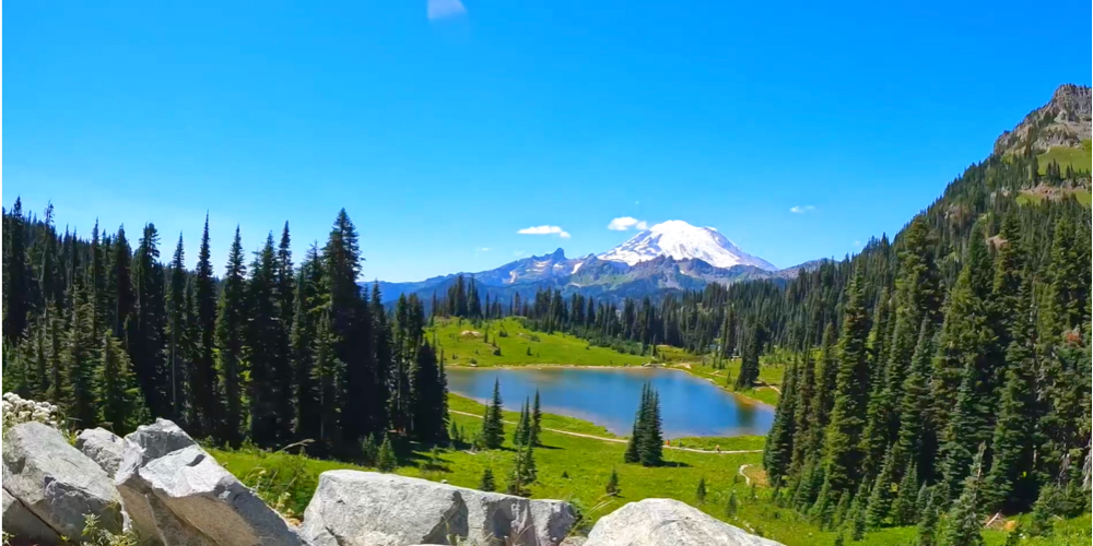
Steve Matson brings us a collection of three routes from Mount Rainier National Park. This stunning region takes its name from the formidable Mount Rainier, an icon in the Washington landscape.

The mountain is an active volcano and the most glaciated peak in the contiguous United States of America, spawning five major rivers.

It’s hard to pick a stand out this week, as all three rides offer stunning views of the iconic mountain, however, the Paradise Inn Climb is a long gradual climb to the Paradise Inn at the top. Along the ride, you’re offered incredible views of the snow-capped Mount Rainier in the distance as you pedal through old-growth forests and past waterfalls.

You can find these rides under NEW in FulGaz or by searching Matson.

PARADISE INN CLIMB

The ride begins at the Nisqually entrance to Mt. Rainier National Park, on the west flank of the mountain. It passes through impressive old growth forests at a 2% grade following the Nisqually River up to Longmire village. Then it tips up to 4–6% for the rest of the climb, passing numerous trailheads and waterfall lookouts, until emerging above the tree line and arriving at the Paradise Inn at 5488 feet. The lodge was built in 1917 and is listed on the National Registry of Historic Places. This ride is the most popular, welcoming, and scenic route on the mountain, and as you near the top, views of majestic glaciers and late summer wild flowers will emerge—along with lots of tourists!

More Info
28.10km
DISTANCE
01:20:38
DURATION
1003m
ELEVATION

SUNRISE VISITOR CENTER ON MT RAINIER

The road to Sunrise Visitor Center climbs to 6400 feet, the highest paved road in Mt. Rainier National Park and in Washington State. Starting at White River campground, the climb averages 5.4% for the first 7.5 miles until it eases up at Sunrise Point. Then you rise above the tree line through subalpine meadows as Mt. Rainier and Emmons Glacier fill the horizon in front of you

More Info
16.51km
DISTANCE
01:01:11
DURATION
721m
ELEVATION

CAYUSE AND CHINOOK PASSES ON MT RAINIER

On the northeast slopes of scenic Mt. Rainier National Park, the ride climbs Highway 410 through forests and ridges to an elevation of 5400 feet. After about 8.7 miles, the ride summits Cayuse Pass, but continues up another 4 miles to the top of Chinook Pass. In the first half of the ride, you will see glimpses of the mountain on your right side, but it’s out in front in all its glory by the end of the ride. The route passes the glacial cirque of Tipsoo Lake before looking back down on the lake and out to the mountain.

More Info
20.36km
DISTANCE
01:04:59
DURATION
818m
ELEVATION