West Virginia with Rick Norton

It’s been a minute since Rick Norton’s last collection but you can expect more of his West Virginia goodness.

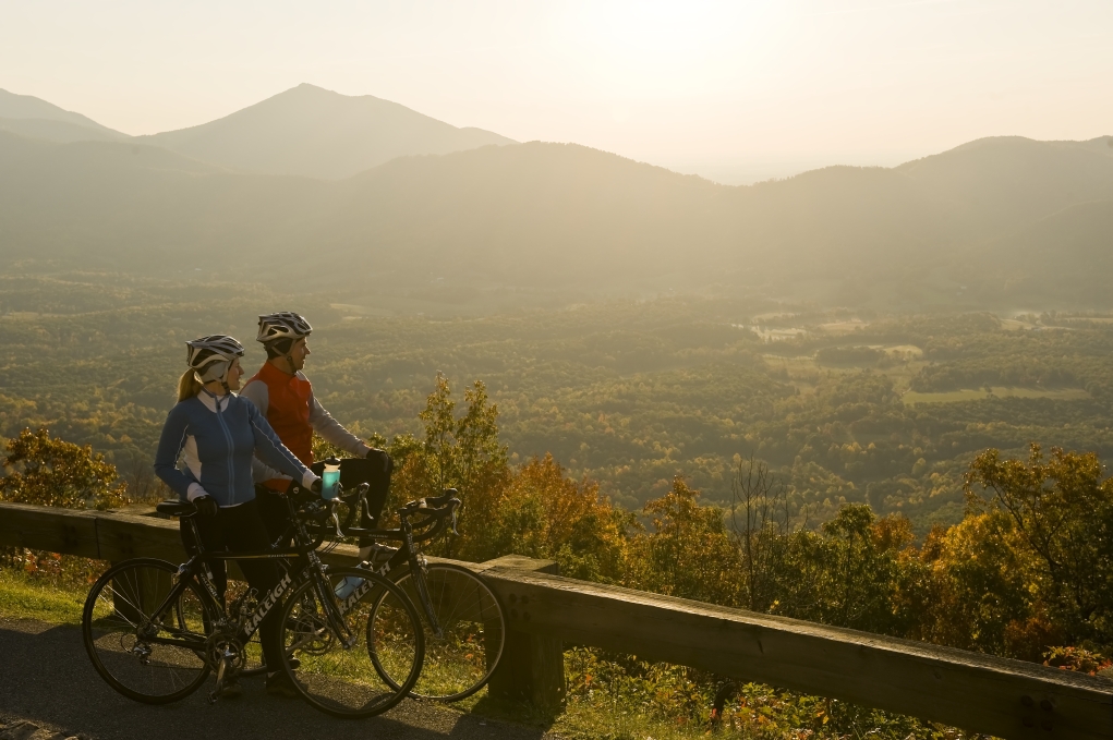
Rick’s rides are characterised by green trees, gravel and rolling hills.

There’s only one or two killer climbs so this is ideal for someone looking for a workout, but not smashing themselves against a huge mountain.

You can find these routes and more by searching “Norton” in the FulGaz app.

Happy trails!

BLUE GRASS VALLEY

Blue Grass Valley Rd is a North/South road from the edge of WV at the south branch of the Potomac River back into VA between the ridges of Monterey mountain and climb 2 of the Monterey video. It is intended as a recovery ride with the mostly gentle grades and the predominantly descending roads for the final 3 miles. Enjoy the views on a nearly cloudless blue sky late Spring day.

More Info
21.64km
DISTANCE
00:44:13
DURATION
293m
ELEVATION

AFTON SWITCHBACKS 2.0

Afton Switchbacks 2.0 is an updated version of the original ride now including da switchbacks! This time you start with almost 2 miles of switchback descending before joining the original gently descending route. Once again you get the same gentle rollers through rural farmland, horse country, and lots of wineries. Once you pass one final huge horse farm and the local peach and apple orchard you continue past the old finish gently climbing on Mint Springs Rd to the local park and its inviting lakes!

More Info
30.88km
DISTANCE
00:54:54
DURATION
353m
ELEVATION

HEARDS GRAVEL

Cruising out from the small rural town of Batesville, I divide this ride into 5 sectors of gravel. The first 2 are classic local up and down gravel roads of about 2 miles each. The next 2 sectors include the bigger climbs of Spring Valley Rd (past a scenic cherry orchard with a steep kick finish) and the very steady 2K climb of Heards Mtn Rd. A welcome scenic descent beckons an easier finish and our final sector the ALMOST flat Cove Garden Rd!

More Info
31.88km
DISTANCE
01:09:53
DURATION
569m
ELEVATION

CATOCTIN RIDGE RECOVERY RIDE

Starting near the old military base of Fort Ritchie (you can see the current satellite towers above the base) and the top of Catoctin Mountain Park (Camp David is about 1.5 miles due East) the route is almost all gently descending to the southern base of the Catoctin Ridge. You’ll be sure to question this description as the first mile gently rises, but from then on get your big ring recovery going via rural back roads along the valley on the western side of the Catoctin Ridge.

More Info
22.13km
DISTANCE
00:35:05
DURATION
116m
ELEVATION

MONTEREY TO THE WEST VIRGINIA BORDER

Route 250 goes from Richmond, Virginia all the way to West Virginia. The last 50 miles of this road are sometimes ridden as a century (out and back) with constant sawtooth climbing. This ride leaves from the final town in VA with a stop sign over 3 ridges to the WV border. The first climb is a very steady 6-7% and 3 miles long. Climb two is the shortest but a little steeper (1.6 miles). Climb three is the longest (4 miles) but with a few dips. Enjoy the two descents, the first one is a ripper!

More Info
21.41km
DISTANCE
00:57:23
DURATION
853m
ELEVATION

MARYLAND PRO CYCLING CLASSIC

The Maryland Cycling Classic is a UCI pro men’s race on Sunday September 5. The race starts in Baltimore County and does about 70 miles before making it to Baltimore City for the finishing circuits. The county is hilly! The FulGaz version is a 50 mile loop that includes a long stretch of the iconic Falls road horses and hounds region AND the good ol’ Prettyboy Reservoir loop (on another FulGaz ride). If you tire of all the short sharp climbs, don’t worry - only the first 48 miles are hilly, the final 2 miles are downhill to the start!

More Info
78.53km
DISTANCE
02:29:29
DURATION
1240m
ELEVATION

ALHAMBRA BLUE RIDGE GRAVEL CLIMB

Alhambra is a 9.5 mile long part paved/part gravel climb that does not actually intersect with the Blue Ridge Parkway. Because it does not connect or cross the parkway it is a VERY lightly traveled road (mostly used by campers). It is a kinder summer climb as it is pretty densely tree covered and runs along the Piney River for almost its entire duration. I included the similarly secluded and picturesque gravel warm up climb, Jack’s Hill to help you prep for this long climb. Chances are stronger for you to outpace the filming speed as there is some quite chunky gravel with large rocks in places. Enjoy the solitude!

More Info
20.32km
DISTANCE
01:07:24
DURATION
890m
ELEVATION

Subscribe to FulGaz

Now available on a wide choice of platforms including Android, Apple TV, iPad, MacOS, iPhone and Windows. FulGaz offers you the ultimate ride!

Pricing