Virginian Ventures with Rick Norton

Image via https://blog.virginia.org/

One of the most common questions we get asked at FulGaz is “What makes a good FulGaz ride?”.

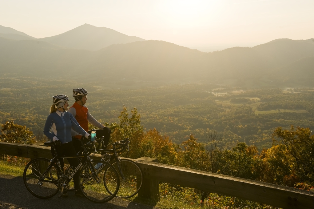
This question is VERY subjective, but we always come back to the guiding principle that some of the best rides are the unique ones from lesser-known riding regions.

This collection from Rick Norton fits this brief perfectly with a series of rides that feature rolling hills and offer a snapshot into the everyday riding from the region.

You’ll find a lot of short sharp little climbs followed by descents to recover on, making them ideal for interval training, using the natural terrain of the region.

A variety of terrain including smooth tarmac and crunchy gravel will make you fall in love with Virginia. Keep an eye out on the descents of “Reddish Knob Climb” for the other film crew!

BLUE RIDGE PARKWAY CRUISE

The Blue Ridge Parkway is the US’s original infrastructure project after the great depression of the 1930s. We are still reaping the benefits, a glorious road along the ridgeline of the Blue Ridge Mountains from central VA to the edge of North Carolina, Tennessee, and Georgia. We start with a side roads loop including a stair step and an increasingly steep 2.5 mile climb before a fun 1 minute highway descent back on the spur road to the parkway. A gradual 2 mile climb on this road leads to another 3.5 miles of climbing on the parkway (gentle grades and superb tarmac). We ride the parkway for about 18 miles with only one brief detour onto a scenic side road (bc who doesn’t like a quick 14% kick in the teeth!). Enjoy incredible views from the top of the rises with the scant Spring leaf cover and ESPECIALLY enjoy the flowing 3 mile S curves descent at the end!

More Info
50.54km
DISTANCE
01:46:53
DURATION
1074m
ELEVATION

CROZET GRAVEL NORTH PART ONE

A delightfully remote gravel road ride from the Moorman’s River (fed by the local Sugar Hollow reservoir) through picturesque Albemarle County horse farms (and a winery or two). The route only has one longer climb on Fox Mountain Rd and is otherwise characterized by lots of rolling up and down. Wesley Chapel is the perfect example of this rollercoaster terrain where you will be rewarded for driving into the short hills from the bottom in order to crest the hills with only a few gear changes. Enjoy the blue skies and nascent Spring greening of the foliage without having to suffer in a stiff wind!

More Info
26.29km
DISTANCE
00:56:33
DURATION
455m
ELEVATION

CROZET GRAVEL NORTH PART TWO

The return trip after Crozet Gravel North part 1. This ride starts on paved roads with nice views of the mountains before hitting the gravel and several large horse farms. Ballard Road up and down gravel (hillier) and Clark Road gravel (flatter but very twisty) are two very prestigious segments held by local pros. You finish passing a local vineyard then a short descent to the river that started the part 1 ride.

More Info
23.15km
DISTANCE
00:52:25
DURATION
369m
ELEVATION

WVA MOUNTAINS AND RIVER BLISS

A super scenic mountains and rivers loop. Start with a stiff 2 mile climb (to 3,000 feet) from the 1 stop sign town of Sugar Grove. Descend to one of several streams that will empty in the South Fork of the Potomac River. A short rise leads to an 8 mile gentle 1% down twisty Thorn Creek road along this stream on your right. You finally cross the stream and begin a long climb back to about 3,000 feet on Dry Run road. After several miles of gentler grades the road pitches up in the town of Dahmer to reach the peak. Another long descent follows leading to the final climb up Simmons Mountain rd. Once you reach this final 3,000 foot peak it's a fun twisting fast 3 mile descent to the finish.

More Info
45.09km
DISTANCE
01:39:26
DURATION
996m
ELEVATION

REDDISH KNOB CLIMB

Reddish Knob is the high point of the border between VA and WVa (4400 feet). The top has a complete 360 degree panorama view of both states. The ride starts in the 1 stop sign town of Sugar Grove giving you a view of the mountain and a gentle 2k descent into the start of the climb. Part 1 is about 3.0 miles of mostly 5-7% with a short 1k descent in the middle. Part 2 is the toughest stretch - about 3.5 miles of 8.5% (with steeper pitches). Watch out for the skateboarding crew filming a descent on this part! Part 3 starts with 1k of flat on the top of the crest between the states before turning right on a stair step 2.3 mile one lane road along the top of the ridge. Enjoy the expansive views at the top!

More Info
17.29km
DISTANCE
00:54:58
DURATION
886m
ELEVATION

SAMS CREEK MD FARMLAND IN SPRING

Trying to capture the nascent greening of Spring across some open Maryland farmland and mostly gentler grades. I filmed this thinking it could be a scenic not too difficult possible recovery ride (as long as you don’t try to crush the speed on the tailwind parts - it was windy!). Enjoy the open views including lots of cows and horses and glimpses of the distant Catoctin ridge to the west without any leaves or tall grasses just yet.

More Info
29.13km
DISTANCE
00:52:13
DURATION
315m
ELEVATION

Subscribe to FulGaz

Now available on a wide choice of platforms including Android, Apple TV, iPad, MacOS, iPhone and Windows. FulGaz offers you the ultimate ride!

Pricing